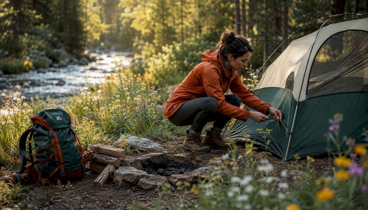
A secluded campground is any site where physical access barriers, deliberate spacing, or public-land rules produce genuine solitude. That means backcountry tent sites, boat-in spots, dispersed National Forest clearings, and private rustic properties where multiple sites might spread across a large natural area. The fastest route to one follows three steps: pick your land type and region, confirm access requirements and current alerts, then pack for complete self-sufficiency before you leave cell range.
TL;DR: Choose a land type (BLM, National Forest, NPS backcountry, or private rustic), verify the access route and any permit requirements, and carry everything you need because no services will be waiting.
The institutions and standards that govern these trips appear throughout this guide:
- Campgazer — campground search and trip-planning platform with 10,000+ listings and community reports
- Bureau of Land Management (BLM) — manages vast dispersed-camping public lands across the West
- U.S. Forest Service (USFS) / National Forests — administers dispersed camping and backcountry permits on National Forest land
- National Park Service (NPS) — manages backcountry permits and strict camping rules inside National Parks
- Leave No Trace Center for Outdoor Ethics — sets the ethical framework for low-impact camping
Table of Contents
- 1. Best secluded campgrounds across U.S. regions
- 2. How to find secluded campgrounds using maps, land types, and search tactics
- 3. Access details and permit rules you need to check before you go
- 4. Leave No Trace rules, stealth-camping legality, and local ordinances
- 5. Safety checklist and essential gear for truly remote trips
- 6. Trip timeline, seasonality, and what secluded sites typically cost
- 7. How Campgazer helps you find quieter campsites
- Key Takeaways
- Why the quietest sites are never the ones you find on the first page
- Plan your next secluded trip with Campgazer
- Authoritative sources and further reading
1. Best secluded campgrounds across U.S. regions
The eight sites below span the country. Each one earns its place because a real access barrier, not just a marketing label, creates the solitude. Use these as starting points for your own research rather than a final booking list, since conditions, fees, and permit requirements change seasonally.
| Region | Site | Access Type | Permit/Reservation | Suitability |
|---|---|---|---|---|
| Pacific Northwest | Harlequin Campground, North Cascades | Ferry, floatplane, or hike | First-come; no road access | Tent/walk-in only |
| Northern Rockies | Campbell Creek, Laramie Mountains (WY) | Long unpaved forest road | Recreation.gov reservation | Small trailers, tent |
| Southwest | Intermountain dispersed sites, Uinta-Wasatch-Cache NF | Unpaved forest road | No permit; MVUM required | 4WD/high-clearance |
| Great Lakes/Upper Midwest | Crescent Lake, Superior National Forest (MN) | Boat-in or forest-road hike | First-come backcountry | Canoe/kayak, tent |
| Upper Midwest (private rustic) | Kona Hills Campground, Marquette, MI | Paved to gravel access road | Reservation recommended | Tent, no hookups |
| Northeast/Adirondacks | Adirondack Wilderness backcountry, NY | Hike-in (1+ miles) | Free; DEC registration for groups | Tent only |
| Southeast/Appalachia | Shining Rock Wilderness, Pisgah NF (NC) | Hike-in (2+ miles) | Free dispersed; no fire permit | Tent only |
| Alaska | Chugach National Forest dispersed sites | Floatplane, boat, or long gravel road | No permit; self-registration | Tent, high-clearance |
Harlequin Campground, North Cascades (Pacific Northwest)
Getting to Harlequin Campground means crossing Lake Chelan by ferry or floatplane, or hiking in on foot. There is no road. The campground has vault toilets and food storage lockers, and sites run around $20 per night for a primitive experience with zero cell signal. That combination of water crossing and minimal infrastructure keeps crowds away reliably.
Campbell Creek Campground, Laramie Mountains (Northern Rockies)
Campbell Creek sits at 7,920 feet in the Douglas Ranger District of Medicine Bow-Routt National Forest. Six widely spaced sites sit under mature pines beside a creek, with picnic tables, fire rings, a vault toilet, and a pump water well. The road in passes through LaPrele Canyon and crosses LaPrele Creek multiple times, which naturally limits traffic to campers who know it's there.
Intermountain dispersed sites, Uinta-Wasatch-Cache NF (Southwest)
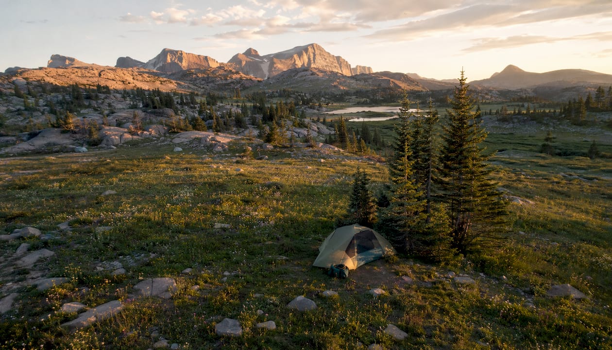
The Intermountain Region's dispersed camping framework covers millions of acres across Utah, Nevada, Idaho, and Wyoming. No designated site, no fee, no reservation. You pull a Motor Vehicle Use Map (MVUM), identify a legal travel corridor, and set up at least 200 feet from water and trails. High-clearance vehicles open up the most remote drainages.
Crescent Lake, Superior National Forest (Great Lakes/Upper Midwest)
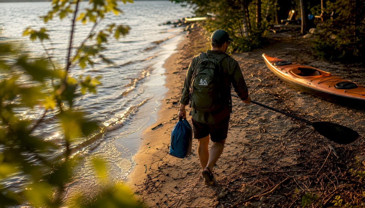
Crescent Lake in Superior National Forest offers undeveloped waterfront campsites alongside boat-in backcountry options. Backcountry sites are first-come, first-served, and you navigate to them using a forest map. The heavily wooded shoreline and lack of maintained facilities mean you'll often have the water to yourself on a weekday.
Kona Hills Campground, Marquette, MI (private rustic)
Kona Hills spreads roughly 40 sites across 80 acres of Upper Peninsula forest, creating a dispersed feel inside a managed property. No hookups, natural site spacing, and a dark-sky designation make it a reliable option when you want solitude without committing to a multi-mile hike. Reservations are recommended in summer.
Adirondack Wilderness backcountry, NY (Northeast)
The Adirondack Park's backcountry allows free dispersed camping at least 150 feet from water, trails, and roads, provided you hike at least one mile away from a trailhead. Groups of ten or more need a DEC permit. The sheer size of the park means that even on summer weekends, a mile of elevation gain separates you from the trailhead crowds.
Shining Rock Wilderness, Pisgah National Forest (Southeast/Appalachia)
Shining Rock is a designated Wilderness area in western North Carolina where no permit is required for dispersed camping. The white quartzite ridgeline is striking, and the two-plus-mile approach on the Art Loeb Trail filters out casual visitors. No campfires are permitted above 5,000 feet, so carry a stove.
Chugach National Forest dispersed sites (Alaska)
Alaska's Chugach National Forest covers nearly 6 million acres, and dispersed camping is permitted throughout most of it. Access ranges from floatplane drops to long gravel roads. No permit is required for most areas, but bear canisters are strongly recommended and, in some zones, required. This is genuinely remote camping in solitude.
2. How to find secluded campgrounds using maps, land types, and search tactics
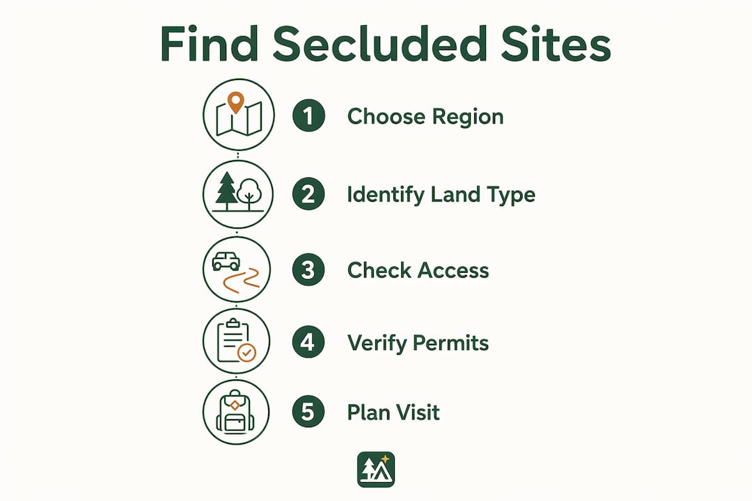
The search workflow that actually works follows a logical sequence: choose your region, identify the land type that fits your access capability, scan the road or water approach lines, then confirm seasonal alerts before you commit. Skipping any step usually means arriving at a gate or a closed road.
Which land types produce the most solitude
National Forest dispersed camping is the most accessible entry point for most campers. On the majority of National Forests, you can camp anywhere not posted as closed, provided you follow the 200-foot setback from water and trails and move every 14 days. No fee, no reservation. The USFS Motor Vehicle Use Map shows which roads are open to motor vehicles and which are closed, which is the single most useful document for planning a dispersed trip.
BLM lands follow similar dispersed rules across the West. The BLM's land-status maps identify which parcels are open for overnight use. Much of Nevada, Utah, Arizona, New Mexico, and Wyoming is BLM land, and the sheer scale means you can drive for miles without seeing another camp.
Wilderness areas inside National Forests and BLM lands add a layer of restriction: no motorized vehicles, no mechanized equipment, and often a permit quota for popular zones. The payoff is that quotas keep crowds genuinely small.
State DNR remote sites vary widely. Wisconsin's DNR, for example, lists remote camping properties accessible only by watercraft or by hiking at least one mile from a parking area, with some requiring a special permit and offering no regular maintenance. Check your state's DNR page directly.
Private rustic campgrounds with large acreage and low site density can deliver solitude without the navigation challenge. Look for properties advertising no hookups, natural spacing, and dark-sky conditions.
How to read access descriptors
When a listing says "boat-in," that means no road access at all. "Walk-in" usually means a short carry from a parking area, not a full backpacking approach. "4WD/high-clearance" is not a suggestion: a two-wheel-drive sedan will get stuck or bottom out, and recovery in a remote canyon is expensive. "Unpaved miles" matters more than total distance. Twenty miles of washboard gravel takes longer and beats up a vehicle more than 50 miles of paved highway.
Tools that actually uncover quiet sites
The USFS Motor Vehicle Use Map is the authoritative source for road-legal access on National Forest land. BLM land-status maps show ownership and open-use areas. Topographic maps from USGS, loaded into Gaia GPS or CalTopo, let you check elevation, drainage, and whether a road dead-ends before you drive it.
Community-verified trip reports reduce uncertainty about remote-site access, road conditions, and actual solitude in ways that official maps cannot. A report noting "4-mile unpaved approach, need 4WD, two other rigs when we visited in July" tells you more than any database field. Campgazer's community-contributed photos and site notes work the same way: real campers describing what they actually found.
Pro Tip: Three signals reliably predict solitude before you ever leave home: a dark-sky designation, fewer than five recent reviews on any platform, and a long unpaved approach noted in community reports. If all three appear together, you've likely found a genuinely quiet spot.
3. Access details and permit rules you need to check before you go
Access barriers are what make a campground truly secluded. Water crossings, floatplane requirements, and long unpaved forest roads all filter out casual visitors in ways that a "primitive" label alone never does.
Common access barriers and what they demand
- Water access (ferry/floatplane): Sites like Harlequin Campground require crossing Lake Chelan by ferry or floatplane. No car, no trailer, tent and pack only. Check ferry schedules well in advance because they run on fixed timetables.
- Boat-in backcountry: Crescent Lake's backcountry sites require paddling or motoring to reach them. Carry a forest map because GPS alone may not identify the correct landing.
- High-clearance/4WD roads: Many dispersed sites on BLM and National Forest land sit at the end of roads rated for high-clearance vehicles only. Check the MVUM for road class before you go.
- Hike-in (1+ miles): Wilderness and some state DNR sites require at least a one-mile carry from the trailhead. That distance alone eliminates most casual campers.
Permit types and when first-come-first-served fails you
Many dispersed sites on National Forests and BLM lands are genuinely first-come, first-served with no permit required. But popular backcountry zones, Wilderness areas with quota systems, and boat-in sites with a limited number of food lockers operate differently. Some state DNR remote sites require a special permit and are not regularly maintained, meaning you're on your own if something goes wrong.
First-come-first-served is unreliable during peak summer weekends and holiday weeks. If a site has a permit quota, the quota fills weeks or months ahead. Always check the specific forest or park permit page and carry a printed copy of your permit or the map coordinates of your intended site.
The 200-foot guideline: The Leave No Trace Center for Outdoor Ethics recommends camping, cooking, and disposing of waste at least 200 feet (roughly 70 adult paces) from lakes, streams, trails, and roads. NPS backcountry rules and many state park regulations codify this distance as a hard requirement. On dispersed National Forest and BLM land, it is the standard best practice even where not legally mandated. Measure it out once on flat ground so you can pace it accurately in the field.
How to verify access before you commit
Call or email the local ranger district or BLM field office directly. Ask three things: Is the road to [site name] currently open to motor vehicles? Is an overnight permit required? Are there any current fire restrictions or closures? Official Forest Service and BLM pages post travel advisories and fire restrictions, but they sometimes lag behind conditions on the ground. A five-minute phone call to the ranger station is the most reliable check.
4. Leave No Trace rules, stealth-camping legality, and local ordinances
The ethical and legal framework for secluded camping is not complicated, but getting it wrong can mean a fine, a damaged ecosystem, or a closed area for future campers.
Core Leave No Trace practices for remote settings
The Leave No Trace Center for Outdoor Ethics identifies seven principles, and four matter most in truly secluded settings:
- Pack it in, pack it out. No trash cans exist at dispersed sites. Everything you carry in comes back with you, including food scraps, packaging, and gray water.
- Minimize campfire impacts. Use a stove when fire bans are in effect. When fires are permitted, use existing fire rings, keep fires small, and burn wood to ash. Never leave a fire unattended.
- Camp on durable surfaces. Set up on rock, gravel, dry grass, or established sites. Avoid crushing fragile vegetation or camping on wet soil that compacts easily.
- Respect wildlife. Store food in a bear canister or hang it at least 10 feet off the ground and 4 feet from the trunk. Never feed wildlife, and give animals space to move without altering their behavior.
The legal reality of dispersed and stealth camping
Dispersed camping is legal on most National Forest and BLM land unless a specific area is posted as closed. National Parks are the opposite: camping outside a designated site is generally prohibited, and backcountry permits are required for overnight stays. Many state parks fall somewhere in between, with designated primitive zones and permit requirements.
"Stealth camping," meaning camping on private land, road shoulders, or urban green spaces without permission, is typically trespassing. The term is sometimes used loosely to describe dispersed camping on public land, which is not stealth camping at all. Know the land ownership before you set up.
Before you call a land manager, know what to ask: "Is dispersed overnight camping permitted at [location]? Is a permit required? Are there current fire restrictions or area closures? What is the nearest ranger station contact for emergencies?" Those four questions cover the legal, logistical, and safety bases in under two minutes.
Pro Tip: When you call a ranger district, ask specifically about the road class and whether it's been graded recently. A road that was passable in May may be deeply rutted by August after heavy use. That one question has saved more trips than any map.
Local ordinances add another layer. County fire bans can close dispersed areas even when the Forest Service hasn't issued a restriction. Some counties require a campfire permit year-round. Check both the federal land-management agency page and the county sheriff or fire department page for the area you're visiting.
5. Safety checklist and essential gear for truly remote trips
Remote camping is self-sufficient camping. Wilderness management guidance consistently emphasizes that campers at dispersed and backcountry sites must manage safety, waste, and emergency response without relying on any campground services. Treat a remote camp night like a short expedition.
Before you leave: the non-negotiables
- Leave a detailed route plan with someone at home: trailhead or road-end coordinates, intended campsite location, planned return date, and who to call if you don't check in.
- Download or print a physical map of the area. GPS can fail in deep canyons or dense forest; experienced planners always cross-reference GPS routes with MVUM or topographic maps and note a physical bail-out route before committing to a remote drive-in approach.
- Carry a satellite communicator or PLB. Cell signal is absent at most truly secluded sites. A personal locator beacon (PLB) or two-way satellite messenger (Garmin inReach, SPOT) is the difference between a manageable emergency and a life-threatening one. Carry both if the approach is particularly remote.
- Water treatment. Primitive and dispersed sites rarely have potable water. The CDC recommends boiling, chemical treatment, or a certified filter for backcountry water sources. Carry a filter and backup chemical tablets.
- First-aid kit sized for the trip. Include blister treatment, wound closure strips, a SAM splint, and any personal medications.
Gear prioritized by impact
- Navigation and communication: Physical topo map, compass, GPS device, satellite messenger or PLB, and a fully charged backup battery.
- Water and filtration: Filter (Sawyer Squeeze, Katadyn BeFree, or similar), chemical backup (Aquatabs), and enough capacity for the approach.
- Shelter and insulation: A shelter rated below the expected low temperature, plus an emergency bivy in case of an unplanned night out.
- Wildlife protection: Bear canister or hang kit, bear spray in grizzly country.
- Vehicle recovery (for drive-in approaches): Recovery boards, a tow strap, a high-lift jack, and a tire repair kit for high-clearance approaches on remote forest roads.
Emergency action steps
- Injury: Stabilize, activate your satellite communicator, and stay put unless the location itself is dangerous. Rescuers need your coordinates.
- Lost party member: Stay at the last known point, signal with a whistle (three blasts), and activate your communicator if the person is not found within 30 minutes.
- Wildfire or sudden road closure: Forest Service and park alerts can impose sudden fire bans or vehicle restrictions that block access to remote sites. Know your alternate exit route before you need it. Never drive through active smoke.
6. Trip timeline, seasonality, and what secluded sites typically cost
Solitude is seasonal. The same dispersed site that feels genuinely remote in late September can feel crowded on a July Fourth weekend. Planning around that reality is as important as any gear decision.
When to go for the most solitude
- Shoulder seasons (May to early June, September to October) offer the best combination of access and quiet. Snow has cleared from most lower-elevation roads, but summer crowds haven't arrived yet. Fall color in the Rockies and Appalachians draws some visitors, but weekday travel in September is still reliably uncrowded.
- Wildfire season (July through September in the West) can close dispersed areas with almost no warning. Monitor the Forest Service and BLM alert pages for your target area starting at least two weeks before departure.
- Winter closes most high-elevation dispersed sites and many forest roads entirely. Some lower-elevation BLM sites in the Southwest stay accessible year-round and are actually quietest in winter.
Planning timeline
- Wilderness permit zones with quotas: Apply 4–6 months ahead. Popular zones like the John Muir Wilderness or Boundary Waters Canoe Area Wilderness fill their summer quotas quickly.
- Boat-in sites with ferry schedules (e.g., Harlequin Campground): Check ferry timetables 2–3 months out and confirm seasonal operating dates.
- Dispersed National Forest and BLM sites: No reservation needed, but check road conditions and fire restrictions 1–2 weeks before departure and again the day before.
- State DNR remote sites: Permit availability varies; check the specific state DNR page 4–8 weeks ahead.
What to budget
- Dispersed National Forest and BLM camping: Free in most cases. No site fee.
- Designated primitive sites (e.g., Campbell Creek): Fees are typically in the range of a few dollars to around $20 per night, payable through Recreation.gov.
- Boat-in sites with ferry access (e.g., Harlequin): Ferry or floatplane costs vary and can add meaningfully to the trip budget. Check current rates with the operator.
- Fuel and vehicle wear: A 60-mile round trip on rough forest roads costs more in fuel and wear than 200 miles of highway. Budget accordingly.
- Wilderness permits: Many are free; some popular zones charge a modest per-person fee. Check the specific permit page.
Practical tip: Arrive mid-week. Wednesday and Thursday arrivals at dispersed sites consistently find fewer neighbors than Friday arrivals, even in peak season. A flexible departure date also lets you extend a stay if the site is quiet.
7. How Campgazer helps you find quieter campsites
Campgazer's database covers more than 10,000 campgrounds across the country, and the features that matter most for finding secluded sites are the ones that let you filter by access type, read community-contributed notes, and build a complete itinerary before you leave home.
A practical search workflow
- Set your rig or access filters first. If you're in a high-clearance truck, open the filter to include unpaved and primitive access. If you're in a standard sedan, filter those out. This single step removes dozens of sites that would be inaccessible anyway.
- Search by region and land type. Campgazer's database includes National Forest dispersed areas, state park primitive sites, and private rustic campgrounds. Narrow to your target region and land type.
- Sort by community activity. Sites with very few reviews or recent community flags for solitude are often the quietest. A site with two photos and one trip report from three years ago is a strong signal that crowds aren't a problem.
- Read the community notes carefully. User reports that mention approach difficulty ("4-mile unpaved, need 4WD, washboard in spots") are often the single most predictive factor of solitude. If multiple recent reports describe a rough approach, expect far fewer neighbors.
- Cross-reference with official maps. Once you've identified a candidate, pull the MVUM or BLM land-status map to confirm road access and legal overnight use. Campgazer's community data and official maps work best together.
What Campgazer's community reports actually tell you
A listing's amenity flags show whether a site has potable water, vault toilets, or fire rings, which matters for packing decisions. User photos show the actual site spacing and tree cover, not a stock image. Trip reports from other campers describe road conditions, neighbor density, and wildlife activity in ways no database field can capture. That combination reduces the uncertainty that makes remote trips stressful.
Pro Tip: On Campgazer, look for listings where the most recent community photo shows an empty site or a single rig. That's a real-world solitude signal that no amenity filter can replicate.
You can start a search on Campgazer with rig filters already set, then browse community-verified listings to build a shortlist before you ever open a topo map.
Key Takeaways
Finding a genuinely secluded campground comes down to choosing the right land type, verifying access before you go, and packing for complete self-sufficiency because no services will be waiting.
| Point | Details |
|---|---|
| Choose the right land type | BLM and National Forest dispersed sites offer free, permit-free solitude across millions of Western acres. |
| Verify access and permits early | Wilderness quotas fill months ahead; always check the MVUM and call the ranger district before departure. |
| Pack for self-sufficiency | Carry a satellite communicator, water filter, physical map, and a full emergency kit — no services exist at remote sites. |
| Use shoulder seasons | May to early June and September to October deliver the best access with the fewest neighbors. |
| Use Campgazer to narrow your search | Filter by access type and read community trip reports to identify genuinely quiet sites before you commit. |
Why the quietest sites are never the ones you find on the first page
There's a pattern worth naming: the campgrounds that show up first in any search are, almost by definition, the ones that aren't secluded anymore. The moment a site gets enough reviews to rank well, it's already attracting the volume that erodes the solitude you were looking for. The best remote camping spots tend to live in the middle pages of a search, in a ranger district bulletin, or in a trip report from someone who drove four hours on gravel and didn't see another soul.
What that means practically is that the search process matters as much as the destination. A dark-sky designation, a note about a rough approach, a listing with two reviews and a single photo from two years ago: these are the signals that point toward real quiet. The sites that require effort to find are the ones that reward the effort.
The other thing worth saying: the 200-foot guideline and Leave No Trace practices aren't bureaucratic friction. They're what keeps these places open. A dispersed site that gets overused, fire-scarred, or trashed gets closed. The campers who follow the rules are the ones who preserve the access for everyone who comes after them. That's not idealism; it's just how land management works in practice.
If you've found a site that genuinely surprised you, share the trip report on Campgazer. The community data is only as good as the people who contribute to it, and a well-written report about a rough approach or an unexpectedly beautiful dispersed site is worth more than a dozen generic five-star ratings.
Plan your next secluded trip with Campgazer
Campgazer gives you a real advantage when you're hunting for off-the-beaten-path camping. The platform's rig-clearance filters let you immediately cut out sites your vehicle can't reach, while community-contributed photos and trip reports show you what the approach actually looks like, not what the brochure says. You can flag sites by amenity type (primitive, no hookups, vault toilet only), read user notes about road conditions and neighbor density, and build a complete multi-stop itinerary that accounts for your rig's specs and your preferred land type.
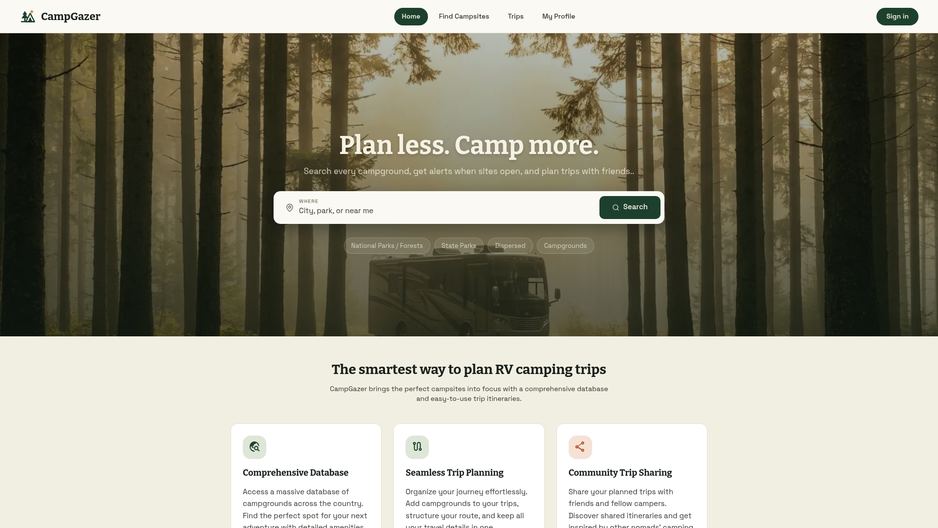
For campers planning trips to dispersed National Forest sites, boat-in spots, or private rustic campgrounds, Campgazer's 10,000+ listing database is a practical starting point that saves hours of cross-referencing ranger district pages. The community reports are the part that makes the difference: real campers describing what they found, not what was listed. Start planning your remote trip on Campgazer and use the rig filters and community notes to build a shortlist of genuinely quiet sites before you ever pack the truck.
Authoritative sources and further reading
Before any remote trip, check these official sources directly. Conditions, permits, and fire restrictions change faster than any article can track.
- USFS Motor Vehicle Use Maps (MVUM): The authoritative source for which roads on National Forest land are open to motor vehicles and which are closed. Download the PDF for your specific forest before departure.
- Recreation.gov: Reservation and permit system for designated federal campgrounds, including primitive sites like Campbell Creek. Check here for permit availability and current fees.
- Superior National Forest — Crescent Lake: Official Forest Service page for backcountry and boat-in site information in the Boundary Waters region.
- Wisconsin DNR Remote Camping: Model state DNR page for remote and watercraft-access sites; check your own state's DNR for equivalent listings.
- NPS backcountry permit pages: Each National Park manages its own backcountry permit system. Go directly to the park's official NPS page for current quotas, fees, and reservation windows.
- CDC drinking water guidance for camping: Official guidance on water treatment methods for backcountry and dispersed sites without potable water.
- Leave No Trace Center for Outdoor Ethics (lnt.org): The standard reference for low-impact camping practices, including the 200-foot setback guideline and waste management protocols.
How to use these sources together: Official land-management pages (USFS, BLM, NPS, state DNR) are authoritative for permits, road status, and legal access. Community reports on platforms like Campgazer fill in the real-world conditions those pages can't capture: current road quality, actual site spacing, and recent wildlife activity. When the two conflict, call the ranger district directly. Official pages are updated on a schedule; a ranger on the phone knows what happened last week.